Japan Earthquake and Tsunami HD Model
Over 30% of Tohuku Earthquake losses were tsunami related. Use our Japan Earthquake and Tsunami HD Model to gain a comprehensive view of risk.

Models, Experts and Coffee
Chesley Williams, Moody’s RMS Sr. Director, Product Management
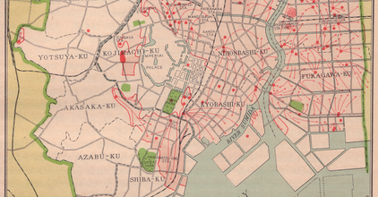
The Great Kanto Earthquake: 100-Year Retrospective
At 11:58 JST on Saturday, September 1, 1923, an Mw7.9 earthquake struck the Tokyo, Japan region. The reported ground shaking lasted longer than four minutes and caused extensive damage to buildings and infrastructure. Total damage at the time of the event is estimated at 6.5 billion yen which is assessed by Moody’s RMS to increase to 48.5 trillion yen or $331B in economic loss in today’s dollars.
Models, Experts and Coffee
Chesley Williams, Moody’s RMS Sr. Director, Product Management
Understand the Complexities of Japan’s Earthquake Risk
A comprehensive solution offering advanced high-definition (HD) earthquake risk management capabilities including an integrated, fully probabilistic tsunami analysis.
Robust View of Risk
Incorporates the latest methodological advancements across all aspects of the model – from liquefaction and vulnerability to a new financial model – offering a more complete and accurate representation of earthquake risk.
Integrated Tsunami Risk
Understand the combined view of earthquake and tsunami risk with a fully probabilistic tsunami model integrated with the earthquake stochastic event set.
New Scientific Insights
Model incorporates key research advancements from the 2017 Japan Seismic Hazard Maps, as well as key lessons learned from the 2011 Tohoku and 2016 Kumamoto Earthquakes.
Japan Earthquake and Tsunami HD Model
A sophisticated modeling solution providing the insight you need to understand, evaluate, and manage the complexities of earthquake risk in Japan.
Latest Data and Research
Incorporating insights from analysis of billions of dollars of claims data from recent events and numerous regional scientific research projects, including studies of larger offshore earthquakes and subsequent tsunami, the model delivers superior representation of earthquake risk variation across Japan.
Quantify Tsunami Impact
With learnings from the 2011 Tohoku event, the integrated tsunami model is based on a full hydrodynamic model of tsunami events, generated on local earthquake sources and modeled at very high resolution.
Improved Loss Assessment
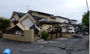
The Japan Earthquake and Tsunami Model assesses building performance to calculate potential property damage and business interruption losses from ground shaking, tsunami inundation, fire following earthquake, liquefaction, and landslides.
Market Focus
Through collaboration with local experts, scientific agencies, and insurers, the model reflects local building codes and construction practices and includes a unique financial model for Japan-specific policy structures and terms (e.g., step policies).
Related Products

Japan Typhoon and Flood HD Model
Gain a greater understanding of typhoon and flood risk using Moody’s RMS Japan Typhoon and Flood model.
Risk Modeler 2.0
Unlock insights and improve real-time decision-making with cloud risk modeling software.
Resources

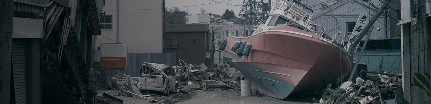
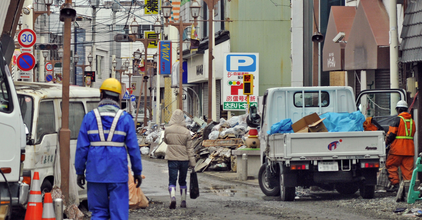
A Look Back at the 2011 Great East Japan (Tohoku) Earthqua...
Major earthquake disasters are fortunately rare, but when they happen, it is an opportunity to learn and continue to push the boundaries of earthquake science and engineering. Ten years ago, on March 11, 2011, at 2:46 p.m. local time, an M9.0 earthquake occurred offshore of the east coast of the Tohoku region on the island of Honshu, Japan. It was the most powerful earthquake ever recorded in the country. The epicenter was 80 miles (130 kilometers) east of Sendai and 231 miles (373 kilometers) northeast of To...
Japan Seismic Risk: Don’t Forget the Faults!
Japan and more specifically Tokyo lie at the intersection where the Pacific and Philippine Sea tectonic plates are pushed under Eurasia. It is not surprising then that megathrust earthquakes along these tectonic plate boundaries drive the seismic risk in this region with their large magnitudes and relatively short return periods. It is important to understand that the story of seismic risk does not end there. In Japan, like many other places around the world where there are major subduction zones, a component of...

RMS Releases New Japan Earthquake and Tsunami High Definit...
TOKYO, Japan - May 02, 2018 RMS, the leading global risk modeling and analytics firm, announced today the release of its new Japan Earthquake and Tsunami High Definition (HD) model. RMS has collaborated with local experts, scientific agencies and insurers to develop a model that offers a more complete and detailed representation of earthquake and tsunami risk in Japan. The new model incorporates key research advancements from the 2017 Japan Seismic Hazard Maps, as well as lessons learned from the 2011 Tohok...

Putting the Power of HD Modeling to Work in Three Updated ...
At the RMS Exceedance 2020 virtual conference in May, we shared with attendees our product release plan covering a number of models. Today, we are delighted to announce the availability of three new models for our customers. Together with the U.S. Wildfire HD Model, these models all use the new high-definition (HD) modeling framework and are available in our Risk Modeler 2.0 application today. These include: Japan Typhoon and Inland Flood HD Model: Latest view of risk, incorporating learnings fr...
Tohoku Earthquake and Tsunami: Ten Years of Aftershocks
The Japan Meteorological Agency recently called the M7.1 earthquake on February 13, 2021, an aftershock of the March 11, 2011, Mw9.0 Tohoku event, nearly 10 years after the original mainshock. How long should a community wait after an earthquake before they return to their homes or start to rebuild? When is the risk of aftershocks over? Awareness of aftershocks has carried through the centuries. The concept of an “earthquake quarantine” was evident in the Italian town of Pistoia, Tuscany, some 10 miles (16 ki...
A Look Back at the 2011 Great East Japan (Tohoku) Earthqua...
Major earthquake disasters are fortunately rare, but when they happen, it is an opportunity to learn and continue to push the boundaries of earthquake science and engineering. Ten years ago, on March 11, 2011, at 2:46 p.m. local time, an M9.0 earthquake occurred offshore of the east coast of the Tohoku region on the island of Honshu, Japan. It was the most powerful earthquake ever recorded in the country. The epicenter was 80 miles (130 kilometers) east of Sendai and 231 miles (373 kilometers) northeast of To...
Japan Seismic Risk: Don’t Forget the Faults!
Japan and more specifically Tokyo lie at the intersection where the Pacific and Philippine Sea tectonic plates are pushed under Eurasia. It is not surprising then that megathrust earthquakes along these tectonic plate boundaries drive the seismic risk in this region with their large magnitudes and relatively short return periods. It is important to understand that the story of seismic risk does not end there. In Japan, like many other places around the world where there are major subduction zones, a component of...
RMS Releases New Japan Earthquake and Tsunami High Definit...
TOKYO, Japan - May 02, 2018 RMS, the leading global risk modeling and analytics firm, announced today the release of its new Japan Earthquake and Tsunami High Definition (HD) model. RMS has collaborated with local experts, scientific agencies and insurers to develop a model that offers a more complete and detailed representation of earthquake and tsunami risk in Japan. The new model incorporates key research advancements from the 2017 Japan Seismic Hazard Maps, as well as lessons learned from the 2011 Tohok...
Putting the Power of HD Modeling to Work in Three Updated ...
At the RMS Exceedance 2020 virtual conference in May, we shared with attendees our product release plan covering a number of models. Today, we are delighted to announce the availability of three new models for our customers. Together with the U.S. Wildfire HD Model, these models all use the new high-definition (HD) modeling framework and are available in our Risk Modeler 2.0 application today. These include: Japan Typhoon and Inland Flood HD Model: Latest view of risk, incorporating learnings fr...

Find the Model to Fit Your Needs
