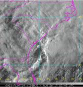
Hurricane Matthew has tracked most of the way up the Florida coastline as a Category 3 major hurricane. Matthew tracked further offshore than previously forecast, placing the worst of the storm’s winds and storm surge offshore of Florida. While there have been hurricane force winds onshore and some damage from Matthew along portions of Florida’s east coast, thankfully the levels of damage in Florida that we are seeing are lower and less widespread than we expected just 24 hours ago.
As Matthew continues to track along the coastline, our focus shifts north towards Georgia and South Carolina, with a potential landfall near Charleston, South Carolina as a Category 2 hurricane. Even if landfall does not occur, there is significant flood risk in the southeast U.S., including high storm surge risk from Jacksonville northward to Charleston, SC. As a large, slow moving storm, Matthew has been absorbing a lot of tropical moisture and building up a lot of rising water over its lifecycle. This increases the potential for heavy rainfall and significant build-up of water along the southeast coastline, which features greater storm surge potential than eastern Florida due to local bathymetry. The magnitude and extent of storm surge-driven coastal flooding, exacerbated by the occurrence of astronomical high tide cycles, is expected to rival that of Hurricane Hugo (1989).
Bands of heavy rain are extending as much as 500 miles north-northeast of Matthew into Georgia and the Carolinas, suggesting that the storm could cause excessive rainfall and precipitation-induced flooding over the next few days. Rainfall estimates in excess of one foot (30 cm) are expected along the coast of South and North Carolina, two areas where soils are already heavily saturated and river levels are high based on significant rainfall over the last few weeks. According to the National Weather Service in Charleston, South Carolina, coastal and inland flooding impacts could be comparable or worse than the October 2015 flood event.
A shift in Matthew’s movement could have a large influence on the impacts both along the coast and further inland.
Over the past several days, Matthew’s forecast has changed significantly.
To assist our clients in understanding the full range of potential outcomes from Matthew, we continue to select stochastic events from our North Atlantic Hurricane model to represent the range of potential scenarios as the situation evolves. These have been provided to our clients on a daily basis, along with information regarding the modeled losses of these scenarios from our Industry Loss Curves. As the forecasts have evolved, so have the events we selected to represent the range of scenarios. As would be expected with a shift in forecast away from the Florida coast over the past 24 hours, today’s event selection saw a significant reduction in losses.
As a measure of the change in just 24 hours, the average industry loss of the 15 selected events yesterday was $20bn, with losses from the individual scenarios ranging from $7bn to $54bn. Today, the average loss of the 10 selected events was just $6bn, with losses from the individual scenarios ranging from less than $1bn to $19bn. This illustrates that the range of potential outcomes has shifted significantly, but it still remains wide – and continues to evolve.
But these are just modeled scenarios, chosen based on track parameters that are already out of date.
Just as the average loss from the range of scenarios doesn’t mean much, individual scenario losses shouldn’t be viewed as loss estimates for Matthew: they are chosen to help our clients make sense of what’s happening. Tomorrow these will change yet again as the official forecasts are updated and our understanding of the storm evolves.
Efforts towards determining RMS’ official loss estimate for a hurricane begin once the storm has fully passed.
This is when our modelers can begin producing reconstructions of the hurricane’s windfield and storm surge extent. In significant hurricane events, such as Matthew, RMS modelers and experts are also deployed to survey damage on the ground. Matthew’s ultimate behavior, including a possible recurvature towards The Bahamas and Florida next week, could potentially delay these efforts.
In the meantime, as Matthew is still evolving, so is our response.
The RMS Event Response team will continue to provide daily event reports with updates to the stochastic event selections daily through the weekend. The RMS Knowledge Center will also be on hand through the weekend should any questions arise.
Let’s see what tomorrow brings.
This post was co-authored by Emily Paterson, Tom Sabbatelli, Ben Brookes, and Paul Wilson.