I am in Wellington, New Zealand, looking out from a rainy hotel window high over the city, admiring the older wooden houses on the forested slopes. Below there are four to eight story office and retail buildings, a number of which are shrouded in scaffolding, still repairing damage from the 2016 Kaikoura earthquake. The earthquake epicenter was some distance from the city, but the pattern of fault ruptures propelled long period ground shaking into the heart of Wellington.
In 1848, only eight years after the city was founded, a Mw7.5 earthquake on the far side of Cook Strait, shattered the town’s brick buildings. The Lieutenant Governor, Edward Eyre, forgetting his official role as colonial booster, declared the “… town of Wellington is in ruins … Terror and despair reign everywhere. Ships now in port … (are) crowded to excess with colonists abandoning the country.” However, the tremors declined, and the town survived.
Many ordinary houses were rebuilt using wood instead of brick. As a result, they suffered far less damage from a larger and closer Mw8.2 earthquake in 1855, that struck at the end of a two-day public holiday to celebrate the fifteenth anniversary of the city’s formation. This ruined all the remaining brick and stone commercial buildings including churches, barracks, the jail, and the colonial hospital. However, the earthquake delivered a tectonic bounty, raising the city by one to two meters (3.2 to 6.5 feet), turning the harbor into new land for development.
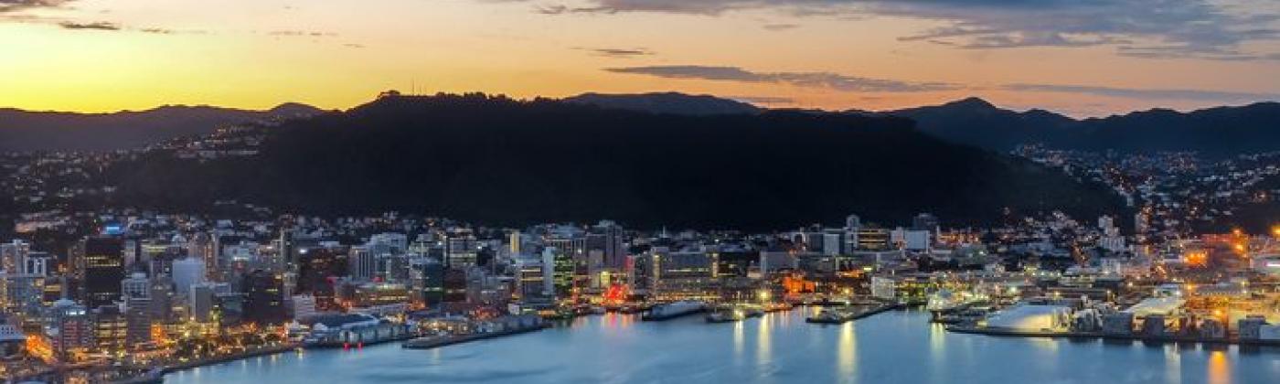
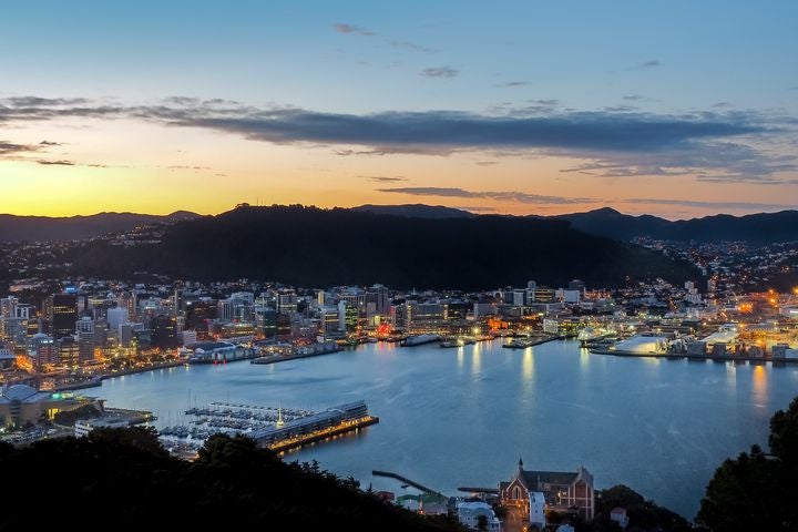
Night view from Mt. Victoria over Wellington, New Zealand.
At the midpoint of the two main islands, Wellington was declared New Zealand’s capital in 1865. (Auckland had been derided as too remote from the south). It was not until a century later that the 1848 and 1855 earthquakes were explained: the city lies in a nest of faults that absorb components of the Australia-Pacific plate boundary. If we knew in 1865 what we know today, perhaps the city would not have been capitalized?
In Harm’s Way
Many of the people who live and work in Wellington are not here because of the port or the rich agricultural hinterland, but because the government has chosen to run its functions at this location. And this puts people in jeopardy of losing their home, their place of work or even their life. Then there are the support functions of a capital, equally in harm’s way: the hotels, restaurants, schools, colleges, offices, and agencies. It is not just New Zealanders at risk, but international workers required to work in embassies, corporate headquarters and international agencies. When the city of Port-au-Prince, Haiti (another plate-boundary capital) was devastated in 2010, among the tens of thousands of the dead were 82 UN personnel, from a wide range of countries, who were required to be based in the city.
Yet it is not just a question of personal safety. The modern focus on building codes can help reduce casualties in earthquakes but will not mitigate expensive structural damage. The costs of sustaining a capital city on a plate boundary are substantial. There are the direct costs of all the measures taken to reduce the risk, strengthening lifelines, implementing building codes, the additional costs of hardening all new buildings and retrofitting older buildings – before one gets into insurance costs and disaster management. For Wellington, the full annual cost of responding to the catastrophe risk from earthquakes and floods might be several billion dollars a year, money which could be spent on education or healthcare if the capital was situated away from the hazard frontline.
Also, money, on its own, cannot compensate for everything that happens in a disaster: the distress and inconvenience, the displacement, the wasted time. By locating their capital on the tectonic front line, the functioning of the government itself is placed at risk, threatening to weaken the whole country should a major earthquake disable the city.
No one is currently expected to account for these costs. When a government builds a flood defense to protect a community, they are making a commitment to continue that protection into the indefinite future. If the hazard is itself rising – as with sea levels – then these costs will accelerate, and the future financial commitment may become prohibitively expensive. Rather than build the original defense it might have been better to relocate the community to somewhere not subject to the hazard.
Ultimately the choice of where a government locates its capital relative to the landscape of hazards becomes not just an economic question but an ethical issue.
The most effective way of managing this risk long-term is not to buy more insurance or improve the compliance of building codes (both of which are valid short-term measures), but to relocate the capital somewhere with a low catastrophe risk profile.
Wellington is not the only capital city sited in a nest of hazards. Tehran, Manila, Kingston Jamaica, and Caracas are all situated next to dangerous faults, components of plate boundaries, while Lima and Tokyo are located directly above plate boundary megathrusts.
How realistic is relocation? Canberra and Brasilia were new capital cities founded because of pre-existing and intractable inter-city rivalry. In 1923, low-risk Ankara replaced high earthquake risk Istanbul as the capital of Turkey (although earthquakes were not cited as justification).
Since 2010, the government of Iran has relocated around 100,000 government, military, and university personnel out of Tehran in fear of the consequences of a large earthquake.
Measuring the “relocation dividend” will require catastrophe risk modeling. All countries should perform an audit of the urban risks from the principal catastrophe perils, as well as the actions being taken to try to “manage” those risks. How much is it costing to sustain the current location of their capital and where could a lower hazard alternative be found? It is not just capital cities. Think of the billions that could be saved through focusing urban growth where it will cost less to defend: substituting inland Orlando for high wind and flood risk Miami, or low earthquake hazard Fresno for San Francisco.
Where carefully planned, relocation can be a most effective way of closing the protection gap.
Robert Muir-Wood works to enhance approaches to natural catastrophe modeling, identify models for new areas of risk, and explore expanded applications for catastrophe modeling. Robert has more than 25 years of experience developing probabilistic catastrophe models. He was lead author for the 2007 IPCC Fourth Assessment Report and 2011 IPCC Special Report on Extremes, and is Chair of the OECD panel on the Financial Consequences of Large Scale Catastrophes.
He is the author of seven books, most recently: ‘The Cure for Catastrophe: How we can Stop Manufacturing Natural Disasters’. He has also written numerous research papers and articles in scientific and industry publications as well as frequent blogs. He holds a degree in natural sciences and a PhD both from Cambridge University and is a Visiting Professor at the Institute for Risk and Disaster Reduction at University College London.