RMS Models Offer New Probabilistic Approach to Simplify Flood Management Across Southeast Asia
Simon AthawesMay 04, 2021
The approach of the 10th anniversary of the 2011 Thailand floods, in July, offers a timely reminder of why the insurance market needs to understand the factors that drive flood risk in Southeast Asia, across countries such as Thailand, Malaysia, Indonesia, and Singapore. The 2011 floods represented the second-highest insured loss for a flood event ever recorded, with losses totaling US$15 billion. The record was overtaken in 2017 by insured losses from the floods that followed Hurricane Harvey in the U.S.
Today I’d like to announce that the RMS® Southeast Asia Inland Flood HD Models will be available in early 2022. These are the world’s first fully probabilistic models that offer both a unified and fully correlated view of risk across Southeast Asia (Indonesia, Malaysia, Singapore, and Thailand). (Re)insurers will now have the necessary tools to reduce portfolio blind spots that can occur from intra- and inter-seasonal flood events like tropical storms and monsoons, which caused the 2011 Thailand Floods.
Remove Portfolio Blind Spots with the Most Comprehensive View of Flood Risk in the Region
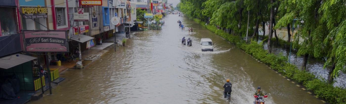
The Southeast Asia region has a predominantly tropical climate with distinct wet and dry seasons, driven by monsoon winds. The southwest monsoon, which typically occurs between May and September, brings the wet season in northern Thailand and also overlaps with peak typhoon activity between June and October, amplifying flood risk in the region. The 2011 Thailand Floods resulted from a heavy monsoon season from May to October and Tropical Storm Nock-ten in July, which was the trigger event.
Together these events caused flooding in 65 out of 76 provinces, and impacted 13 million citizens, nearly 20 percent of the population. Around 1,300 industrial facilities and factories, including many global businesses such as Honda, Western Digital, Toyota, and Canon, saw direct damage to stock and machinery causing significant disruption to manufacturing and many global supply chains.
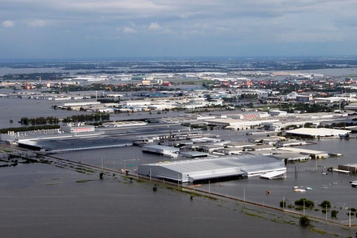
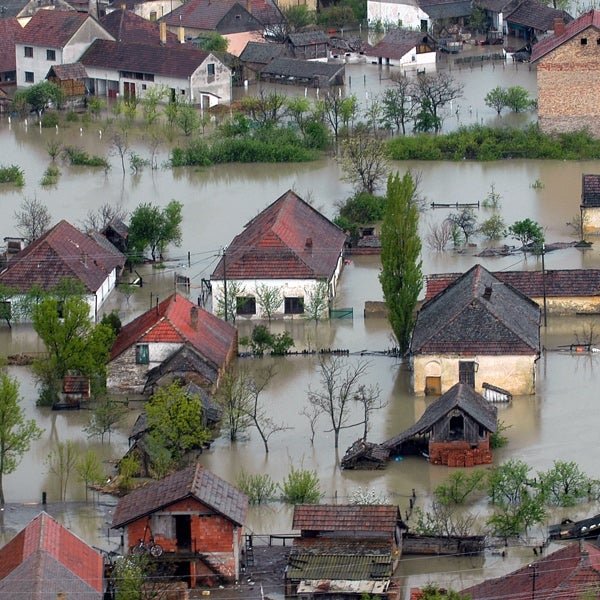
Image: Floodwaters inundated Rojana Industrial Park in Ayutthaya Province, Thailand during the 2011 floods. Source: U.S. Marine Corps photo: Public Domain
The 2011 Thailand Floods highlight the power that the Southeast Asia region has to surprise the market with significant tail risk losses. While the 2011 floods did not have the same impact on the rest of the region as compared to Thailand, there is a real need to understand all sources of flood risk and the spatial and temporal correlation of flood risk, as the monsoon climate can cause flooding across multiple areas at the same time. Flood events do not observe borders, so using a consistent modeling methodology ensures you get a single view of risk across the region.
To address this challenge, the RMS Southeast Asia Inland Flood HD Models are the only models that offer a consistent set of correlated events across the Thailand, Malaysia, Singapore, and Indonesia insurance markets.
Our models capture all sources of inland flood risk (fluvial and pluvial flooding from precipitation sources including monsoon rains, heavy rainstorms, and tropical cyclones) and include over 400 water-based damage curves for buildings to help improve risk selection. Across the region, a river network of over 47,200 miles (76,000 kilometers) is explicitly modeled, including the upper reaches of rivers that rise in neighboring countries, such as the Mekong River which flows from China through Thailand.
Improve Risk Selection with the RMS Advanced HD Modeling Framework
We all know that flood is a high-gradient and attritional peril. Two neighboring buildings may experience different levels of inundation based on small differences in terrain or the presence of flood defenses. It is therefore critical that flood models are high resolution and closely reflect the on-the-ground picture. To capture this risk, the Southeast Asia Inland Flood HD Models run on the most advanced risk framework, all powered by the best available local hazard and flood exposure data at the highest resolution.
The new RMS Southeast Asia Inland Flood HD Models are based on a high-resolution digital terrain model (DTM), up to 20 meters resolution in high exposure areas, with the flood hazard stored on a uniform grid at approximately 38-meter resolution. Other model features include exposure disaggregation, to allow for ground-up simulation of losses at location level even with aggregate input exposure data, and temporal simulation for applying time-based policy terms such as hour-clauses.
For vulnerability, model users benefit from over 100 unique primary building damage curves per country, and 14 secondary modifiers to refine vulnerability. Whether you capture your own detailed exposure data or allow the detailed building inventory in the models to fill in the gaps, the four-parameter vulnerability uncertainty distribution ensures that the model output realistically represents the loss and claims distribution for the flood peril.
Building a Realistic View of Risk in the Face of Rapid Urbanization
Apart from understanding the complexities of the climate in Southeast Asia (including differences between the southwest and northeast monsoons and corresponding regional wet and dry seasons, or flooding from typhoon activity), factors such as rapid urbanization, flood mitigation measures, and climate change can have significant impact on the level of flood risk.
This is especially evident in major cities such as Bangkok in Thailand, Kuala Lumpur in Malaysia, and Jakarta in Indonesia. Kuala Lumpur, for example, has grown from around a quarter of a million population in 1950 to nearly 8.2 million in the metropolitan area today, with about 30 percent of this growth occurring since 2010.
For cities that have experienced rapid urbanization, like Bangkok, Kuala Lumpur, and Jakarta, gaining a realistic view of flood risk is an immense challenge. To better understand cities with higher concentrations of risk due to rapid urbanization, RMS validated its model with over 50 years of historical loss data from local and publicly available sources.
The Southeast Asia Inland Flood HD Models also include the most robust event set capturing approximately 800,000 flood events based on 50,000 years of continuous simulation. By coupling high resolution insights, with hundreds of thousands of events and decades of validated loss data, (re)insurers have the insights needed to translate flood risk in high-risk areas into policy terms.
Conclusion: Providing Model Coverage for How Risk is Underwritten
The RMS flood risk models for Southeast Asia truly are the most sophisticated on the market, and form part of our wider flood model solutions across the Asia-Pacific region and around the globe. To help our clients model risk for how its written in the region, you can pair the Southeast Asia flood models with our existing earthquake models in the region, providing a robust toolset to model the two major perils impacting the region (up to 99 percent of property average annual loss).
This brings a new dimension to the management of risk in the region and enable you to outperform in these rapidly growing economies and markets. Click here to find out more.
Access broad-scale, well-validated views of flood…
Learn More
Simon Athawes
Product Manager, Model Product Management
Based in London, Simon joined RMS in 2012 and works within the Product Management team, focusing on the Asia-Pacific climate suite of products. He is product manager for the RMS typhoon models for China, Taiwan, South Korea, the Philippines, and Guam, and has most recently been involved in supporting the development of new inland flood models for China and Southeast Asia.
Simon holds a bachelor's degree in Geography from the University of Nottingham and a master's degree in Geological and Environmental Hazards from the University of Portsmouth.