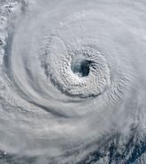
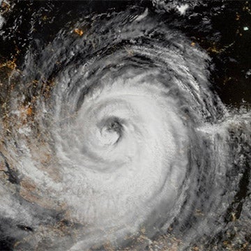
With a few weeks passed since the climatological peak of the 2021 North Atlantic hurricane season on September 10, it’s a good time to review the recent activity trends and look ahead to what may be in store for the rest of this season, which officially finishes on November 30.
Recap Of 2021: Not as Busy as the Record 2020 but Notably Active
The 2020 season was a record-breaker with 30 named storms, including nine that formed before August 1. The 2021 season had matched the pace of last year – with one storm in May and three in June – until a near-silent July. But with seven storms in August and eight so far in September, the North Atlantic has definitely woken up again. The remainder of 2021 looks as if it could also be busier than normal.
For the seventh consecutive year, the season began before the official start with the formation of Tropical Storm Ana on May 22. Tropical Storms Bill, Claudette, and Danny then followed in the second half of June. Elsa achieved hurricane status for a brief stint before land interaction and structural instability weakened the system prior to landfall in Florida’s Big Bend in early July.
After Elsa, there was a month-long pause in activity during July. However, this would be considered the calm before the storm, as August provided us with several impactful events:
- Fred tracked through the Caribbean and impacted the southeastern U.S., landfalling on August 16 as a tropical storm.
- Grace brought flooding rains to Haiti just days after a magnitude 7.2 earthquake shook the Tiburon Peninsula. The system then went on to attain Category 3 major hurricane status (Saffir-Simpson Hurricane Wind Scale) prior to making landfall in Veracruz, Mexico.
- Henri weakened from hurricane status to become the first tropical cyclone to make landfall in Rhode Island since Hurricane Bob in 1991. Henri’s slow track over the northern mid-Atlantic and New England states brought flooding rains to many areas.
- Ida, a Category 4 major hurricane, made landfall over the central Gulf Coast and captured the headlines (see below).
- Tropical Storms Kate and Julian ended August without impacting land.
September has already seen Hurricane Larry make landfall over Newfoundland, Canada, and Hurricane Nicholas make landfall in Texas, while Tropical Storms Mindy, Odette, Peter, Rose, Sam, and Theresa have brought this year’s storm count, to date, to 19, with Victor expected to take that total to 20 in the coming days. Only the record-breaking 2020 season had observed more named storms by September 29.
Ida Leads the Pack
Hurricane Ida was the ninth named storm of 2021, the fourth hurricane, and the fifth named storm to make landfall in the U.S. Ida made landfall near Port Fourchon, Louisiana, on Sunday, August 29, as a Category 4 hurricane.
At landfall, Ida produced maximum sustained winds of 150 mph (241 km/hr), according to the National Hurricane Center and RMS® HWind. This makes it tied for the strongest landfalling storm (by wind speed) in Louisiana history and the fourth hurricane to make landfall in the state since 2020.
Ida will be remembered as a wind and storm surge event in the Gulf Coast and a flood event in the mid-Atlantic and Northeast U.S. It produced significant coastal storm surge inundation, catastrophic wind damage, heavy rainfall, and flash flooding along the central Gulf Coast, primarily in central and southeastern Louisiana and southern Mississippi.
Intense precipitation from Ida’s remnants brought historic amounts of rainfall over just a few hours, with many locations from Philadelphia to New York City experiencing record-breaking six-hourly rainfall totals that caused widespread fluvial and pluvial flooding. The Northeast also experienced heavy rainfall from Tropical Storm Henri a few weeks prior, which created saturated antecedent conditions that exacerbated the extent and severity of flooding in Ida.
RMS estimates total onshore and offshore U.S. insured losses from Hurricane Ida to be between US$31 billion and US$44 billion, by far the costliest event of the season so far.
Latest Forecasts Call for a Busy Rest of the Season
As is customary, many of the forecast groups and agencies updated their forecasts in early August as the season approached its most active period. While most maintain that an above-average season is likely, some slightly decreased their projected tropical storms and hurricane numbers compared to May. These adjustments can be primarily attributed to sea surface temperatures, which have not been as warm as 2020 nor as warm as previously forecast for 2021.
But the Gulf of Mexico is certainly almost always an area to watch for future development, as Ida and Nicholas have already demonstrated. Gulf of Mexico and western Caribbean Sea surface temperatures are still well above average, ideal for storm development and intensification.
It is difficult to tell if the downward adjustments to the forecasts in August would still have been made knowing what was to come in August and September. However, the 2021 season is still forecast to be above average, and tropical storm development is still a serious concern as we close September and move into the second half of the hurricane season.
With La Niña now likely to develop later in the year and vertical wind shear expected to decrease, an increase in cyclogenesis across the Basin is more likely compared to average. Combining this with the warm sea surface temperatures, especially in the Gulf of Mexico, those with interests in the Caribbean and southern United States will need to continue to pay attention in the weeks and months ahead.
Ida would already rank in the top 10 of costliest hurricanes, if early prognostications bear out, so are there more intense events yet to come? Remember, we have seen several notable September and October hurricanes in recent years – including Matthew (2016), Irma and Maria (2017), Michael (2018), Dorian (2019), and Sally, Delta, and Zeta (2020) – so we should not rule out additional impactful events before the 2021 season officially closes on November 30.
Be sure to keep an eye on the RMS Blog and our social media accounts (@RMS and @HWind) for the very latest information on tropical cyclone developments in the Atlantic.


