Earthquake risk in North America
(Re)insurance companies need to quantify, differentiate, and manage earthquake risk in the North American region at all levels - from underwriting through to portfolio management, reinsurance, and capital management decisions.
Earthquake risk in North America
Earthquake risk throughout North America is complex and varied. Situated on the North American Plate, the western area is bounded by four plates. It is part of the “Ring of Fire,” however the central and eastern areas are more tectonically stable with fewer known active crustal faults and some concentrated zones of elevated seismicity.
California dominates earthquake risk in the U.S. with an interconnected complex network of active crustal faults. The Pacific Northwest, the New Madrid Seismic Zone, the Great Basin, the Rockies and individual states such as Alaska, Hawaii, and Oklahoma also drive tectonic activity.
Distant inland locations such as Mexico City face significant implications from subduction events in western states in Mexico along the Ring of Fire, where geotechnical complexities add to its risk profile. Intraslab earthquakes can occur far inland from the Pacific Coast and impact large western cities and Mexico City.
Seismic hazard in Canada shares the same general U.S. spatial pattern. Risk is focused in British Columbia with interaction between the Pacific and North American Plates. For southwestern British Columbia, the Cascadia Subduction Zone drives seismic hazard. Moving north, hazard is from a strike-slip fault system and plate subduction. Seismicity in eastern Canada is comparatively much lower, with highest seismicity associated with the Saint Lawrence Right Zone in southeastern Canada.
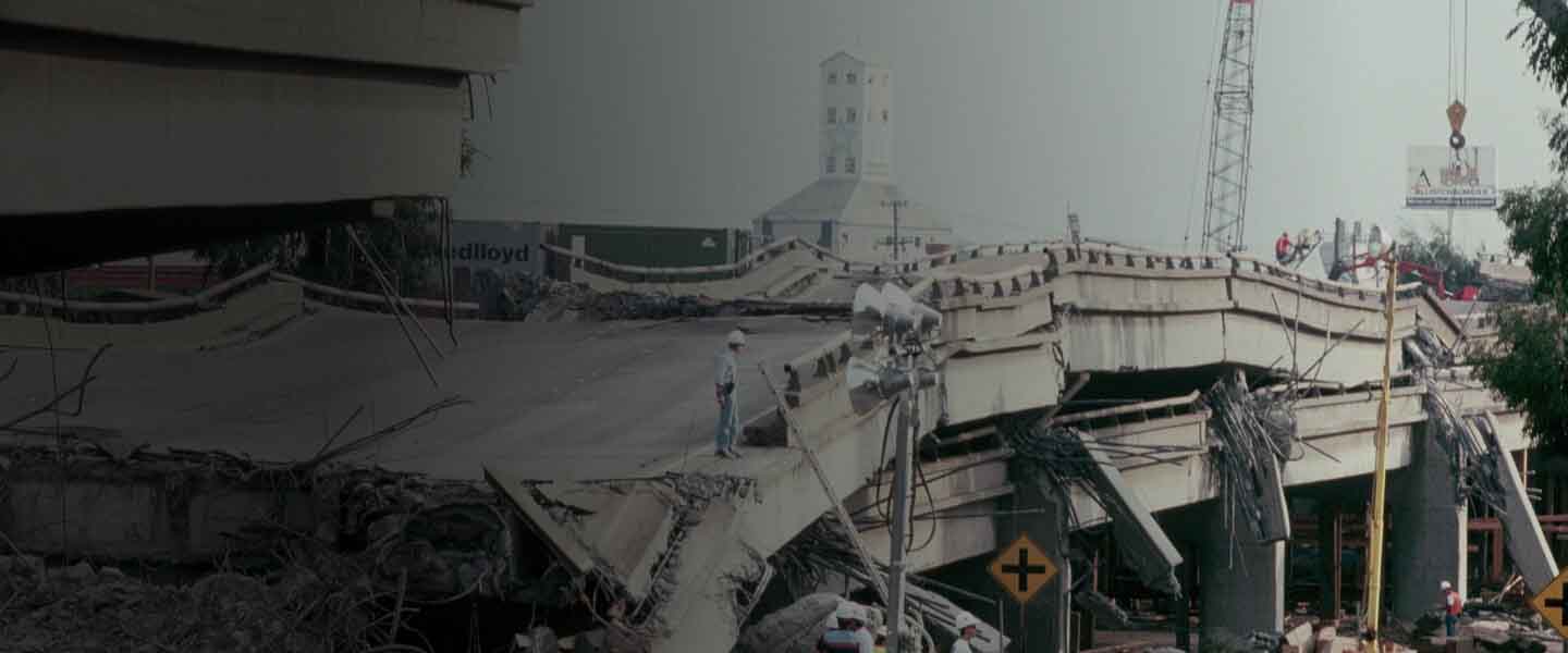
Significant events
In addition to the well-known 1906 San Francisco M7.8 and more recent 1989 Loma Prieta M6.9 California events, Pacific Northwest U.S. states and British Columbia are subject to major subduction events. The 1700 Cascadia M9.0 earthquake, noted through oral traditions among the indigenous people, generated a tsunami with local and far-reaching impacts, intense shaking, and damage.
With Mexico City founded on an old Aztec lake bed, the 1985 Michoacan M8.0 earthquake that occurred where two plates subducted off the Middle America Trench was notable for its basin effects in the city. The energy released during this high-magnitude earthquake had devastating impacts at large distances, causing significant and widespread damage as far away as the city.
Moody's RMS solutions
The Moody's RMS North America Earthquake Models and data offer a seamless seismic source model, covering the entire U.S. including Alaska and Hawaii, Canada, and Mexico. They provide a consistent framework for modeling loss across a range of scales, from location to portfolio, within a city or across country borders. These solutions can build deep insight into the full range of risk – from seismically active western areas through to more tectonically stable central and eastern areas. Companies can use these Moody's RMS models to develop pricing structures that reflect the locations at risk.
