As the industry and modeling organizations continue to learn from the impacts of Hurricane Sandy in 2012, it’s important to know that this event, although historical and record breaking on many counts, was not unprecedented.
The historical record shows that there have been dozens of other tropical cyclones to impact the Northeast U.S., some of which were more intense than Hurricane Sandy from both a wind and surge perspective.
Noteworthy examples include the 1938 New England Hurricane, 1954 Hurricane Carol, and the 1893 New York Hurricane, which will be marking its 120th anniversary on August 24. This storm is notable for being one of only two hurricanes to make a direct landfall in New York City, the other being the 1821 Long Island Hurricane.
First identified as a tropical storm on August 15, 1893 in the central Atlantic Ocean, the storm gradually intensified over the next seven days as it tracked northwestward toward the U.S. By August 22, it had reached its peak intensity of 115 mph (185 km/h), categorizing it as major hurricane status (Category 3). At this point, it began to recurve to the north, bringing it in-line with coastal New Jersey and New York. Two days later, after land interaction with parts of New Jersey resulted in some weakening, the storm made landfall on western Long Island with peak winds around 85 mph (140 km/h).
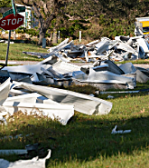
The hurricane impacted much of the coastal and interior portions of the Northeast with tropical-storm force winds, and much of the New York City with hurricane-force winds. From a surge perspective, the storm brought a 30-foot (9.1 m) storm surge that completely flooded southern Brooklyn and Queens, NY, along with many other low-lying regions.
Here is an extract from the New York Times on August 25, 1893.
Given the severity of this storm’s surge component, it is well known for destroying the majority of Hog Island, a 1 mile (1.6 km) long island that existed south of the modern-day Long Island coast.
According to version 13.0 of the RMS U.S. Hurricane Model, if the 1893 New York Hurricane were to occur today, the modeled insured losses from a wind-only perspective would be $6.4 billion, and $6.9 billion from a wind and surge perspective. Although not as damaging as Hurricane Sandy, this storm would be a top-10 historical event in the Mid-Atlantic and Northeast regions.
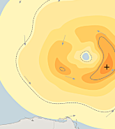
Compared to Hurricane Sandy, the 1893 New York Hurricane was estimated to have been smaller in overall size and intensity at landfall, but significantly larger in terms of surge height and extent. Model-generated hazard and damage footprints for the 1893 New York Hurricane are narrower in width and comparable in terms of peak wind gust.
Further, the impacted areas are confined to coastal New England regions due to the traditional clockwise recurving nature of the storm. On the contrary, Hurricane Sandy took a counterclockwise turn toward the coast just before landfall and prior to recurving toward the north and east, which resulted in a hazard footprint that included many Mid-Atlantic states.
Nevertheless, an event such as the 1893 New York Hurricane demonstrates that from a hazard perspective, Hurricane Sandy was not an once-in-a-lifetime type of storm.
Similar events have and will continue to occur in the future, especially given the period of heightened hurricane activity in the Atlantic, and high surge risk in the Northeast U.S. During this time, it is imperative that the industry increases awareness of these risks and monitors them accordingly.


