The introduction of the Pradhan Mantri Fasal Bima Yojana (PMFBY) insurance scheme in India this year has led to a widely reported increase in the uptake of agricultural insurance across the country.
The scheme has been welcome news to the Indian farming community, who for many years have felt they were not compensated adequately or in a timely manner for losses incurred during the growing seasons. However, there are a number of aspects to be addressed before the scheme can be considered a success, and one of the most notable is regarding Crop Cutting Experiments (CCEs).

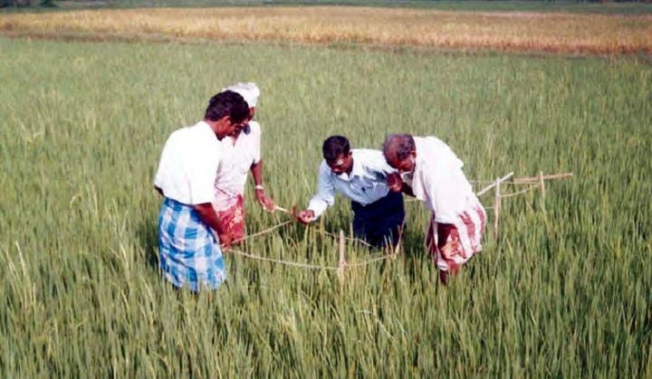
CCEs are used to ascertain the yield for notified crops under the scheme, which are then measured against the insurance threshold yields to determine payout levels. They must be undertaken on-site prior to harvesting and pose a logistical burden in terms of the timely and accurate collection of sensitive data, especially when they are required in such high volumes, as tens of thousands of CCEs are required across the country.
Issues with collecting CCEs has recently made the news, with the suspension of all CCE activity in the northern state of Haryana. Avoiding headlines such as this recent quote from the Times of India is a priority for what many hope is a step change in agricultural insurance in India:
“It has also been decided that the work of CCE will be completely suspended until the required resources, trained manpower with enough budget is provided”—Sushil Goyat, President of Haryana Agricultural Development Officers Association
Technology has a role to play in reducing the logistical burden of planning, executing, and collecting CCEs and the data they gather. So far, satellite imagery has been used to plan CCE schedules and the development of a new mobile application that is capable of geo-tagging photos should increase both the speed of performing each experiment and the confidence level in the data gathered. Yet there is more that could be done with existing data and crop models to reduce the need for such large volumes of CCEs whilst maintaining or improving accuracy.


