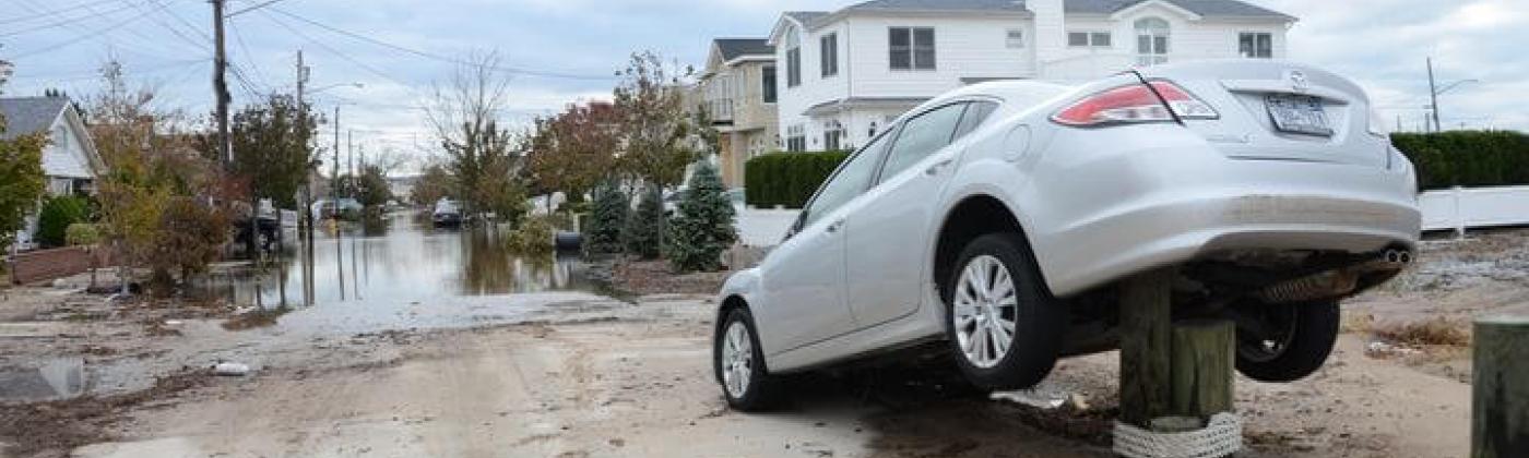
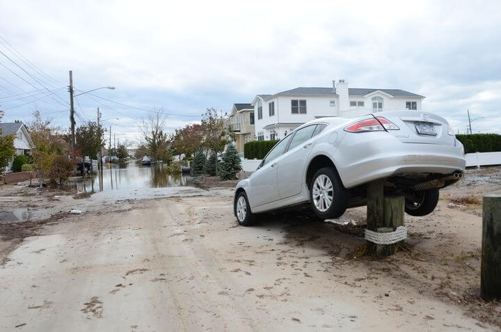
Breezy Point, N.Y., Oct. 31, 2012 – Street scene after Hurricane Sandy. Source: FEMA
Katrina. Sandy. Matthew. We tend to remember the big-name storms that take over the news cycle for weeks, offering up poignant images of rescued families.
Yet many of us barely notice losses racked up annually from flooding events all over the U.S.: flash floods in the Midwest and Northeast, torrential rains in bone-dry Houston, dam spillways exploding in formerly drought-stricken California.
Hurricanes are back too, right on schedule. The Atlantic storm season could bring up to 17 named storms, reports the National Oceanic and Atmospheric Administration. Our own modeling at RMS suggests an economic loss greater than $15 billion from storm surges alone is far from fanciful.
The National Flood Insurance Program (NFIP) is supposed to cover all that, yet the federal program is behind the times and perpetually in the red. The good news: There is real, bipartisan momentum for meaningful reform.
The NFIP began in 1968. Its purpose was to identify which areas of the country are flood prone, develop ways to manage floodplains and provide insurance to businesses and homeowners at risk. We’ve made huge technical leaps in quantifying risk since then, but the government still relies on methods developed by academics 50 years ago.
For one, the Federal Emergency Management Agency (FEMA) still looks at flood risk as a binary problem. Their maps assess whether your home is in danger or not, but cannot help you understand how much danger. Such “in or out” designations do not account for differences in potential flooding depths from one property to the next.
Worse still, low-resolution FEMA cartography is stuck in the age of folded paper maps. Using a FEMA flood map is like opening an app on your phone to find a restaurant and getting only steakhouses, and then not being able to zoom in past city level to pick one. The result: Small differences in premiums that don’t accurately reflect big differences in risk.
Nor does FEMA fairly account for the value of the properties it insures. Property values can vary greatly from town to town, even block to block. Yet NFIP uses a national average, not actual property values. Imagine if everybody paid property taxes not based on square footage but on the average of all home sizes in your town. Small townhouses would subsidize McMansions. That is what happens today with flood insurance.
Hamstrung with techniques developed in the 1950s, the government cannot accurately price coverage. The outcome is predictable: incorrect insurance rates unwittingly underwritten by the taxpayer. The NFIP, which is scheduled this year for reauthorization, currently owes $25 billion to the U.S. Treasury, money it will never pay back under its current operating model. Because the rates do not fully reflect potential flood losses, the program has been labeled “high risk” and structurally unsound by the Government Accountability Office.
Thankfully, those leading reauthorization of the NFIP understand that the answer lies in better risk modeling. This starts with estimating potential losses at various probabilities, beyond FEMA’s so-called “hundred-year” event. Further, FEMA should take into account not just the likely extent of flooding but also likely depth. And it must get better at estimating the economic consequences of water damage.
Moreover, the time has come for FEMA to become a sophisticated buyer of reinsurance. Doing so will reduce taxpayer exposure while allowing the agency to backstop extreme scenarios. Accurate data – reliably modeled and thoughtfully structured – will make insuring that risk attractive to private capital. FEMA can then explore innovative financing options such as “resilience bonds,” which would keep the NFIP on firm financial footing while rewarding investments in flood defenses.
Finally, accurate rates will encourage local governments and communities to take steps to reduce risk. In northwestern Sacramento, for instance, the residents of Natomas supported a $1-billion, 26-mile levee improvement program in the hope of lower premiums. Under a draft bill now in Congress, such community-driven planning could become common. Empowered by data, citizens and local officials can calculate in advance the value of flood mitigation.
Not everyone is in love with the bill, of course. There is an incentive to keep the insurance cost of high-risk properties below market. If premiums were accurate, property values in those parts of the country could fall. Tax collection would take a hit, followed by a decline in city budgets.
As it stands now, the country’s flood insurance program, de facto backstopped by taxpayers, is structurally dysfunctional. Private insurers have no incentive to compete with unrealistically — and unscientifically — priced coverage. Encouraging a private flood insurance market will increase choice and catalyze investments in resilience.
Reauthorization is important. Without the NFIP, flood insurance might not exist at any price. Yet modernization of the program is equally essential. Without change, America’s taxpayers, homeowners, banks and realtors must continue to assume a poorly calculated risk at a staggering long-term cost.
Senior Director - Global Governmental and Regulatory Affairs, Moody's RMS
Matthew leads Governmental and Regulatory Affairs at Moody's RMS, responsible for maintaining relationships with regulators, legislators, and rating agencies on behalf of the company to establish open channels of communication around Moody's RMS models and solutions.
He is a meteorologist and geographer with extensive experience in North American catastrophe risk. In his prior role at Moody's RMS, he was responsible for developing Moody's RMS climate peril models for the Americas, including severe convective storm, winter storm, flood, and hurricane models, and has conducted field reconnaissance for major catastrophes including Hurricanes Katrina and Sandy.
Before joining Moody's RMS, Matthew conducted remote sensing in satellite meteorology research at the Cooperative Institute for Research in the Atmosphere (CIRA). He holds a bachelor's degree in Physics from Ripon College, where he won the Henry Knop Award in Physics and a master's degree in Atmospheric Science from Colorado State University.
Matthew is a member of the American Meteorological Society (AMS), the International Society of Catastrophe Managers (ISCM), and the American Association of Geographers (AAG).