Challenging conventional thinking pays dividends with regards to assessing hurricane risk. And as the current North Atlantic Hurricane Season marches on, here are five points — some of which are insights from last year’s active season, that can help you to reframe and potentially rethink your view of hurricane risk.
1. Hurricane Threat Is Not Just from Wind or Storm Surge
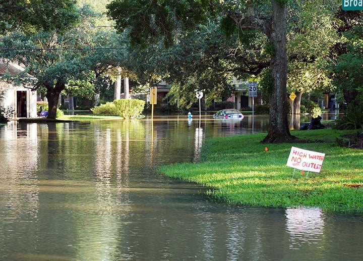
In many respects, Hurricane Harvey was the standout hurricane from last year’s trio of notable events in Harvey, Irma and Maria. The severe amounts of rainfall from Harvey — more than fifty inches (127 cm) in some areas over southeast Texas in August 2017 — certainly differentiated this event.
In 2014, Robert Muir-Wood, chief research officer at RMS, wrote a blog posing the question whether water, and not wind is the primary driver of hurricane risk and corresponding losses. With events like Harvey in 2017, Robert’s viewpoint becomes more and more valid. Although Harvey was a category 4 hurricane at landfall, around 90 percent of the estimated losses were from inland flooding. The dominance of flood-driven losses in recent events — whether they be caused by storm surge, precipitation, or both — argues for a full hurricane catastrophe modeling solution. If tropical cyclone-induced rainfall is not included as a modeled peril, there is every chance of missing a large contribution of total loss for events like Harvey.

2. Just Because You Live Outside the 100-Year Floodplain, Does Not Mean You Are Not at Risk for Flooding or Do Not Need Insurance
This was the stark reality of Harvey. More than half of the homes damaged by flooding from Harvey were outside of current FEMA 100-year flood zone designations (or Special Flood Hazard Areas) and therefore under or uninsured. Current regulations only require properties with federally-backed mortgages that lie within these zones to purchase flood insurance. This perhaps creates the belief that only properties in these areas are at risk. The insurance industry has a huge opportunity to explain the risk and ensure homeowners are offered adequate insurance protection.
3. Tropical Cyclone Observations are Critical
Observational data is vital to help inform and validate accurate representations of a tropical cyclone’s wind size, intensity, and impacts. But as Michael Young, vice president of Model Product Management at RMS illustrated in a blog on Hurricane Maria, one of the biggest challenges in modeling Maria’s wind field was the widespread failure of wind measuring stations across Puerto Rico, including the destruction of the island’s radar dome.
Being reliant on specific data sources can prove problematic, and there is a need to have access to the broadest set of real-time data sources. As Michael mentions in his blog, the use of more than 30 different real-time land, sea, and airborne data sources together with historical wind field data developed by RMS HWind during Maria and the other events last season helped our clients make critical decisions as event unfolded.
4. Flood Mitigation Matters
First-floor height is one of the most critical factors influencing flood damage and loss. Raising a property’s first floor as well as any valuable or easily damaged contents can significantly reduce flood risk. In addition, a range of mitigation products can be implemented for flood protection/proofing, such as flood walls, mechanical vents (like Smart Vent Flood Vents), sump pumps, and also the simple sealing of walls and cracks. RMS incorporates such mitigation products/efforts as secondary modifiers within our models to provide a more accurate risk assessment.
5. IKE: A Better Way to Estimate Tropical Cyclone Intensity and Damage Potential
It is hard to get the whole picture on the destructive potential of a hurricane using metrics based only on the Saffir-Simpson Hurricane Wind Scale or accumulated energy metrics (such as Accumulated Cyclone Energy), as these are only a function of maximum wind speed.
Integrated Kinetic Energy (IKE) could provide a better indicator of tropical cyclone strength and damage potential as it takes into consideration both the size and intensity of the storm’s wind field. Invented by RMS HWind founder Dr. Mark Powell, IKE is a metric to quantify the strength or total destructive potential of the storm, taking into consideration the size and energy of the portion of the wind field with winds above tropical storm force (more than 39 miles per hour).
With an estimated peak IKE of more than 170 terajoules (TJ) for Hurricane Irma, it topped all storms for the 2017 Atlantic hurricane season. With 94 TJ for Hurricane Maria and only 27 TJ for Hurricane Harvey, it gives a sense for the difference in scale — Maria had more than six times the energy of Harvey.


