Overview of Moody's HWind
(Re)insurers, brokers, capital markets, government agencies, and academia rely on HWind products for real-time event preparation and response, the triggering of parametric insurance contracts, validation against experience, and research.
Stay ahead of the storm
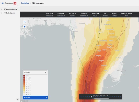
Understand the range of potential losses across multiple forecast scenarios, capturing the uncertainty in how track and intensity will evolve.
Accurate hazard insights
Identify the maximum wind speed experienced at a location to quickly determine if parametric insurance has been triggered and inform claims adjustment.
Validate against history
Demonstrate example pay-outs for past storms and validate pricing for parametric insurance. Calibrate historical claims against hazard for internal views of risk.
HWind real-time analysis
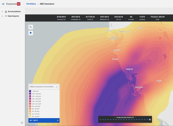
Real-time tropical cyclone data leading up to, during, and following landfall.
Customer success
HWind enhanced archive
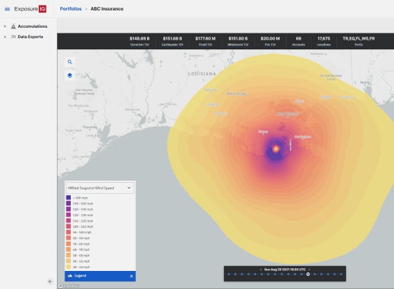
A catalog of 25+ years of high-resolution images, snapshots, and footprints from historical hurricanes
Spotlight

Related products


Learn more
Resources

Exposure Management: Managing the Complexity of Estimating...
When a catastrophic event such as a hurricane or an earthquake strikes, an insurance business relies on the exposure management team to answer the big questions: What level of loss is the business looking at, how much will be recovered from our reinsurance, and how do we communicate this? In a recent blog for insurers, I looked at the importance of real-time event response and exposure management; in this blog, I will focus on reinsurance and the need to generate net loss figures. For most reinsurers, answeri...

What is Possible? Real-time Event Response
It is possible for a portfolio or exposure manager to get near-real-time information during a catastrophic event, so they can meet the decision-making and reporting needs of all their stakeholders.
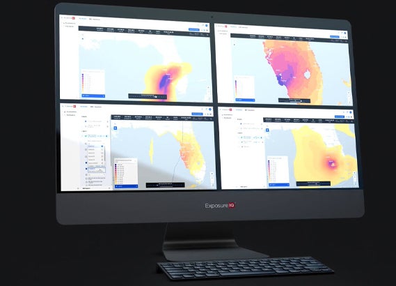
Moody's RMS Event Response with HWind - Hurricane Ian
Moody's RMS HWind produced more than 20 sets of forecasting products, snapshots, and cumulative footprints throughout Hurricane Ian's lifecycle. Learn how HWind customers benefited from real-time insights before, during, and after landfall.
RMS HWind Hurricane Forecasting and Response and ExposureI...
Accessing data in real-time to assess and manage an insurance carrier’s potential liabilities from a loss event remains the holy grail for exposure management teams and is high on a business’ overall wish list A 2021 PwC Pulse Survey of U.S. risk management leaders found that risk executives are increasingly taking advantage of “tech solutions for real-time and automated processes, including dynamic risk monitoring (30 percent), new risk management tech solutions (25 percent), data analytics (24 percent) [and...

Hurricane Ian: The Challenge of Getting Insights into Your...
As soon as Tropical Storm Ian was named on September 26, 2022, our clients using the RMS® ExposureIQ™ application on the RMS Intelligent Risk Platform, have been accessing both our RMS Event Response event footprints and our RMS HWind real-time insights to provide a unique perspective on the progress of the storm. The ninth named tropical storm of the current North Atlantic hurricane season, Major Hurricane Ian made landfall as a Category 4 (Saffir-Simpson Hurricane Windscale) major hurricane near Cayo Costa,...

Hurricane Ian Makes Final Landfall in South Carolina Accom...
As Hurricane Ian departed into the Atlantic from Florida’s east coast at 12:00 UTC (08:00 Eastern Time ET) Thursday, September 29, it then regained hurricane intensity later that day at 21:00 UTC (17:00 ET). It has made an unwelcome return; the National Hurricane Center (NHC) has announced that surface observations indicated that the center of Hurricane Ian made landfall on Friday, September 30, as a Category 1 hurricane at 14:05 ET (18:05 UTC) near Georgetown, South Carolina (pop, ~9,000). It had maximu...

Hurricane Ian: Strongest Hurricane in Southwest Florida Si...
The eighth named tropical storm of the current North Atlantic hurricane season, Major Hurricane Ian, made landfall as a Category 4 (Saffir-Simpson Hurricane Windscale) major hurricane near Cayo Costa, Florida at 19:05 UTC (15:05 Eastern Time ET) on Wednesday, September 28. Ian remerged into the southeast Gulf of Mexico after leaving Cuba as a Category 3 storm on Tuesday, September 27, and strengthened owing to warm sea surface temperatures and generally low vertical wind shear. It completed an eyewall replac...

Hurricane Ian: A Potential Category Five Hurricane?
A quiet North Atlantic hurricane season has certainly kicked into life, as Hurricane Ian approaches southwest Florida as a high-end Category 4 (Saffir-Simpson Hurricane Wind Scale – SSHWS) major hurricane. This is the ninth tropical storm of the current season and the fourth hurricane. Comparing this season to 2021, the ninth storm was Hurricane Ida in late August – and it was the most destructive of that year. Ian made landfall near La Coloma on the southwest coast of Cuba yesterday (September 27) as a Categ...

2022 North Atlantic Hurricane Season Halftime Report: The ...
With a few weeks to go until the North Atlantic Basin enters its most active period, now is a good time to recap recent activity, review updated seasonal forecasts, and look ahead to what may be in store for the remainder of the season. A Slow Start to the 2022 Season The North Atlantic Basin has been a little quiet since the start of the hurricane season. So far in 2022, the basin has not produced any hurricanes and just three tropical storms – Alex, Bonnie, and Colin: A tropical depression brought...

Find the right HWind solution for your organization


