RMS Launches New Zealand Inland Flood HD Model: A New Era for Catastrophe Modeling
Steffi Uhlemann-ElmerMay 04, 2021
When thinking about natural disaster risk in New Zealand, what comes to mind is the country’s exposure to earthquakes. This is natural, given that the world’s second-highest earthquake insured loss ever recorded was the Canterbury Earthquake Sequence in 2010-11, with insured losses of NZ$33–$38 billion (US$23.7–$27.3 billion).
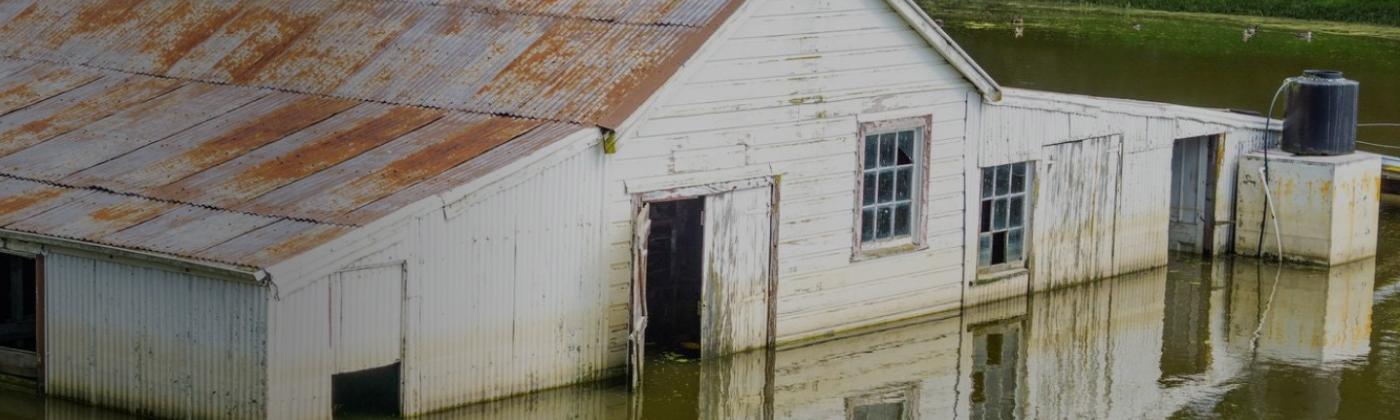
But flood is second in the list of insured losses. Insurance Council of New Zealand (ICNZ) data shows that since 1968 flood accounted for more than 50 percent of all loss events, and damage from heavy precipitation or river flooding represented 60 percent of weather-related losses. Insurance penetration in New Zealand is exceptionally high – around 95 percent of residential policies include flood cover.
Seismic risk dominates solvency concerns for insurers, and the first-ever RMS high-definition risk model was for New Zealand earthquake, with learnings from recent events to better understand the tail risk. Rather than solvency, flood affects earnings volatility as flood losses are typically retained within the insurance market.
As flood events eat into earnings, they come under increasing scrutiny from regulators, reinsurers, and stakeholders, demanding to see modeled flood risk results. With no model available for the market, insurers’ understanding of flood risk comes from a patchwork of hazard maps. Combined with poor awareness of the vulnerability of properties to flooding, this all provides an inconsistent and incomplete basis for pricing and loss accumulation.
Flood Risk in New Zealand
The world’s sixth-largest island country – some 1,000 miles (1,600 kilometers) north- to south, and 280 miles (450 kilometers) at its widest point, with a population of just under five million – covers a variety of climatic zones, from warm subtropical in the north to cool temperate climates in the south. Rainfall is equally variable with the highest-annual precipitation sums recorded on the west coast of the South Island, and much drier conditions over the mountains on the east side.
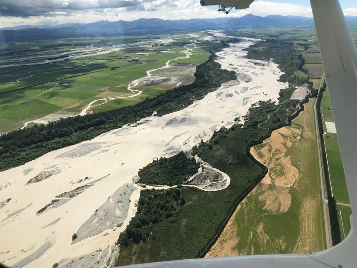
Image: Rangitata River flood, Canterbury, South Island in December 2019. Image by Σ64 - Own work, CC BY 4.0
On the North Island, flooding is often triggered by heavy rainfall brought by transitioned tropical cyclones. One prominent example is Ex-Tropical Cyclone Debbie, the most-costly natural hazard event in 2017, that flooded the town of Edgecumbe generating total losses of NZ$100 million (US$71.8 million). The El Niño Southern Oscillation (ENSO) markedly influences precipitation patterns across the country.
Now, Model 90 Percent of Your Catastrophe Risk in New Zealand
To deliver a more comprehensive catastrophe risk solution for New Zealand, we are launching the RMS® New Zealand Inland Flood HD Model this month, and together with our existing RMS New Zealand Earthquake HD Model, these models will provide advanced risk modeling for the top two natural perils for the country.
Making the models available on the RMS Risk Intelligence™ cloud platform offers new efficiencies. Users can code exposure once and run both flood and earthquake models in the same application, managing over 90 percent of natural hazard risk for the country. This capability allows users to, for example, base reinsurance program structures on the full understanding of the risk.
Furthermore, these models use the high-definition (HD) framework – which has already won awards for our U.S. and Europe Inland Flood HD models. Risk Intelligence is designed to capitalize on this HD framework so users can benefit from high quality insights.
The launch of this new flood model will be a first for the country and comes at the right time as insurers begin preparing for Task Force on Climate-related Financial Disclosures (TCFD) reporting that will become mandatory by 2023.
The First Probabilistic Flood Risk Model for New Zealand
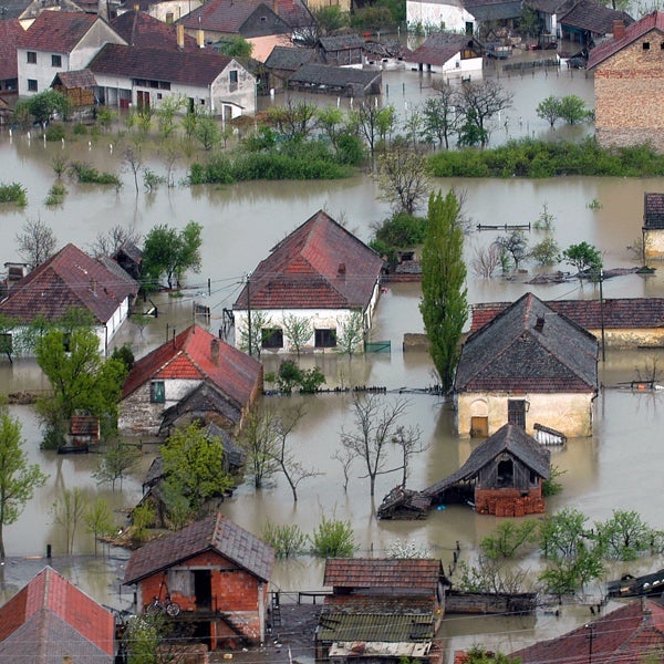
Looking at New Zealand’s flood history, the country has been lucky. No severe rainstorm or flood has hit any of the major exposure centers of Auckland, or Wellington with Lower Hutt, or Christchurch, for example. Flood events in major population centers are physically plausible and not unlikely.
To be able to fully capture the flood risk on a national scale, stochastic modeling of all sources of flooding (from river flooding or a heavy downburst of rainfall) is required, reproducing all likely combinations of weather events across the country through continuous simulation of tens of thousands of years. Understanding tail-risk events is also critical, such as if a major flood hit a highly populated area.
The new RMS New Zealand Inland Flood HD Model is the world’s first fully probabilistic flood model for the country. As with earthquake, the New Zealand flood model is built with exceptional data obtained from local organizations and institutions, including the National Institute of Water and Atmospheric Research (NIWA), Land Information New Zealand (LINZ), local and regional councils and the ICNZ.
ENSO and the Interdecadal Pacific Oscillation (IPO) both markedly affect the variability of precipitation in New Zealand. On average, wetter conditions are observed on the North Island during La Nina. During El Nino, conditions are wetter particularly at the southern tips of New Zealand, while the rest of the country experiences below average precipitation. These climate variables are explicitly identifiable within the model’s event set.
As in our U.S. and Europe Inland Flood HD Models, the New Zealand Inland Flood HD Model is based on 50,000 years of continuous simulation of the entire precipitation cycle capturing the spatial and temporal correlations of flood risk, and all sources of flood – pluvial and fluvial – resulting in a catalog of 350,000 simulated events.
Built With Local Data – And at the Highest Resolution
RMS partners with local organizations to gather best-available local market intelligence and delivers it at the highest resolution in the market. The need for high-resolution modeling applies equally to earthquake and flood perils in New Zealand. Both have very steep loss gradients, and one location could have a very different loss profile to its neighbor.
In the flood model, 80 percent of total insured value across New Zealand benefits from one-meter resolution LIDAR (light detection and ranging) data from LINZ. The hazard model has been developed on a 10-meter uniform resolution grid in urban centers. In addition, the model has been validated against 60 years of insured losses to ensure the most realistic view of risk in the market.
The flood model also includes all publicly available flood defense and mitigation efforts. Flood defenses can be switched on or off within the model to see a defended or undefended view of risk as well as modified to reflect local knowledge about a site’s defense level. This makes a major difference to the risk, with significant exposure within the country defended to a 200-year return period level.
Complete Risk Modeling Solutions for New Zealand
This is an exciting time for the market and the Asia-Pacific region, with the New Zealand Inland Flood HD Model and the New Zealand Earthquake HD Model both set to be available on the Risk Modeler™ application, part of the RMS cloud-based risk management platform, Risk Intelligence. Risk Modeler enables (re)insurers to unlock the value from two exceptional HD Models™ for New Zealand to create new insights and opportunities. As risks and scrutiny increase, RMS offers (re)insurers a comprehensive solution at the right time.
Access broad-scale, well-validated views of flood…
Learn More
Steffi Uhlemann-Elmer
Director, Model Product Management, Flood
Based in Zurich, Steffi joined RMS as Director - Model Product Management in 2019. Coming from the industry, she drives the RMS global flood agenda translating market needs into new product ideas, model improvements and providing insight into risk modeling to optimize client experience and industry understanding of model results.
Prior to RMS, Steffi has accumulated many years of experience in the insurance industry as an expert for flood model validation and in-house model development within the research and development team at Aspen Insurance. In this role, she managed large industry collaborations and has successfully integrated data and results from academic research into commercial applications. An active collaborator in key global flood working groups, she participates in joint publications and supervises master's and PhD students.
Steffi earned her PhD in Hydrology from University of Potsdam and has worked as a flood risk researcher at the German Research Center for Geosciences in Potsdam, Germany. More recently, Steffi completed an immersive course as a Data Scientist.