RMS Launches New Probabilistic Flood Models to Simplify Flood Risk Management Across Southeast Asia
Daniel BernetFebruary 25, 2022
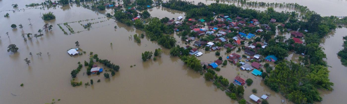
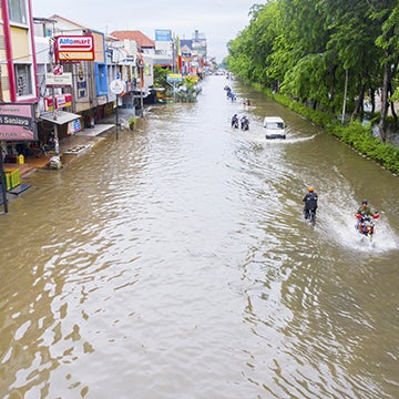
The floods that severely impacted Malaysia and Indonesia between mid-December 2021 and mid-January 2022 remind insurers of the need to better manage flood risk in Southeast Asia, which also includes Singapore and Thailand. Thankfully, these recent floods did not reach the losses of the landmark 2011 Thailand Floods that still rank as second-highest insured flood loss ever recorded.
To give (re)insurers the confidence to move forward with flood risk across a complex region, we are excited to announce the launch of the RMS® Southeast Asia Inland Flood HD Models. The first fully probabilistic models for Southeast Asia – covering Indonesia, Malaysia, Singapore, and Thailand – offer a unified and fully correlated view of inland flood risk. The models give (re)insurers the necessary tools to reduce portfolio blind spots occurring from intra- and interseasonal flood events such as tropical storms and monsoons, which caused the 2011 Thailand Floods as well as the recent flooding in Malaysia and Indonesia.
Remove Blind Spots With the Most Comprehensive View of Flood Risk in the Region
Looking at the regional climate, it is predominantly tropical with distinct dry and wet seasons, driven by monsoon winds. The southwest monsoon that typically occurs between May and September brings the wet season to northern Thailand and overlaps with peak typhoon activity between June and October – amplifying flood risk in the region.
It was a heavy monsoon season from May to October 2011, and a trigger event – Tropical Storm Nock-ten in July, that caused the 2011 Thailand Floods. But the recent December 2021/January 2022 floods in Malaysia and Indonesia were triggered by the northeast monsoon that draws Pacific air masses southwestward. The northeast monsoon brings the rainy season between November and March to Indonesia, Malaysia, Singapore, and southern parts of Thailand.
Both events highlight the complex interactions between monsoons, tropical storms, and typhoons, all with the potential to cause widespread flooding across multiple countries at the same time. There is a need to understand the spatial and temporal correlation of risk from all sources of inland flooding, and as flood events do not respect country borders, a need for a consistent view of flood risk across the region.
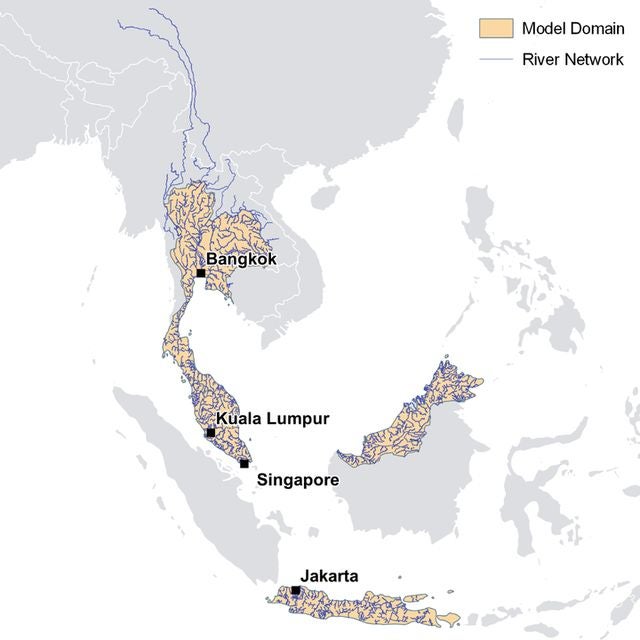
To address this challenge, the Southeast Asia Inland Flood HD Models offer a consistent set of correlated events across the insurance markets of Thailand, Malaysia, Singapore, and Indonesia. Our models capture all sources of inland flood risk: fluvial and pluvial flooding from all precipitation sources including monsoon rains, heavy rainstorms, and tropical cyclones. A river network of over 76,000 kilometers is explicitly modeled across the region (Figure 1), including the upper reaches of rivers that rise in neighboring countries, such as the Mekong River that flows from China through Thailand.
Figure 1: Geographic coverage of the RMS Southeast Asia Inland Flood HD Models highlighting the river network that expands over the model domain’s extent, but is fully modeled as it influences flood risk further downstream.
Get Location-level Insights With the RMS High-Definition (HD) Modeling Framework
Flood is a peril characterized by a particularly high hazard gradient. For example, while one building may experience significant flooding, a neighboring building may stay dry. This could be due to small differences in the terrain or the presence of local flood defenses. It is therefore critical that flood models can realistically reflect these small-scale variations.
To capture these characteristics at a high temporal and spatial resolution, the Southeast Asia Inland Flood HD Models leverage the latest data, science, as well as the latest RMS flood modeling technology. The models are based on high-resolution digital terrain models (DTMs), up to 20-meter resolution in high exposure areas, with the flood hazard stored on a uniform grid at approximately 38-meter resolution.
Other model features include enhanced modeling of aggregate and low-resolution exposure, to allow for ground-up simulation of losses at location level even with coarse input exposure data, and temporal simulation for applying time-based policy terms such as hours clauses.
Flood losses are not only determined by highly variable hazard, but also the different ways exposures experience flood damage. To capture exposure characteristics and how they react to flooding, model users benefit from over 100 flood-specific damage curves for building and contents per country, in addition to 12 secondary modifiers.
Whether you capture your own detailed exposure data or allow the detailed building inventory in the models to fill in the gaps, the four-parameter vulnerability uncertainty distribution ensures that the model output realistically represents the loss and claims distribution of flood events in the region.
Building a Realistic View of Risk in the Face of Rapid Urbanization
Apart from the complex natural processes driving flood risk in space and time, factors such as rapid urbanization and flood protection measures can have significant impact on the level of flood risk. This is especially evident in major cities such as Bangkok in Thailand, Kuala Lumpur in Malaysia, and Jakarta in Indonesia. Kuala Lumpur, for example, has grown from around a quarter of a million population in 1950 to nearly 8.2 million in the metropolitan area today, with about 30 percent of this growth occurring since 2010.
For cities that have experienced rapid urbanization, gaining a realistic view of flood risk is a great challenge. Building the model on the latest data and considering the effect of flood-generating mechanisms of these vast built-up areas is crucial.
Therefore, the RMS flood model developers have spent a lot of effort to gather, review, and augment the best-available data, including many local data providers. Moreover, for the first time, they have explicitly accounted for the impact of the drainage network to provide a more realistic estimate of surface water runoff in these important urban areas.
The models also include the most robust event set capturing more than 800,000 flood events based on 50,000 years of continuous simulation. By coupling high-resolution insights, with hundreds of thousands of events and decades of validated loss data, (re)insurers have the insights needed to translate flood risk in high-risk areas into policy terms.
Providing Model Coverage for How Risk Is Underwritten
The RMS Southeast Asia Inland Flood HD Models are the most sophisticated flood models available on the market. They form part of our wider flood model solutions across the Asia-Pacific region and around the globe. To help model risk for how its written in the region, clients can pair the flood models with our existing regional earthquake models, or leverage RMS Global Flood Hazard Maps to manage flood risk in territories not covered by the probabilistic flood models.
Overall, RMS flood model solutions greatly enhance the management of risk in the region and enables you to outperform in these rapidly growing economies and markets.
The four RMS Southeast Asia Inland Flood HD Models – same as all HD models, run on the open and modular, cloud-based RMS Intelligent Risk Platform™. The models can be licensed individually, all together, or accessed through RMS Analytical Services. Click here to find out more.
Join RMS on March 01, 2022 3 p.m. SGT (Singapore), or at 3 p.m. CET (Europe) for a webinar entitled "Southeast Asia Flood Risk is Complex, Managing it Shouldn’t Be" - click here to find out more and register.
As an assistant director working in model product management, Daniel is responsible for the Moody's RMS Europe Inland Flood as well as the Europe Severe Convective Storm Models. He has been with Moody's for more than 6 years, joining the company after conducting doctoral and postdoctoral research at the Mobiliar Lab for Natural Risks, University of Bern, focusing on the occurrence and modeling of surface water flooding.
Before academia, he worked for a small Swiss NGO managing different water-related projects in Nepal, following the conclusion of a bachelor's and master's degree in Environmental Engineering at the Swiss Federal Institute of Technology ETH Zurich.